The technology behind the experience.
We bring models, spatial information and simulation together to help people explore complex environments through immersive technology.


A model connected to its context.
A digital twin links a physical environment to a model and to the information that describes it. That might be drawings, surveys, asset records or measurements.
Some twins use live data. Many do not need to. The right connection depends on the question being asked.

Explore what could change.
Simulation lets people compare scenarios inside a model. They can see how a layout, a process or a condition might behave when something is altered.
It supports understanding and discussion. It does not predict the future with certainty.
Every place has a context.
Geographic information, geometry and location show how things sit together. Roads, buildings, waterways and networks all depend on what is around them.
Bringing that structure into a model helps people see relationships that a single drawing can hide.
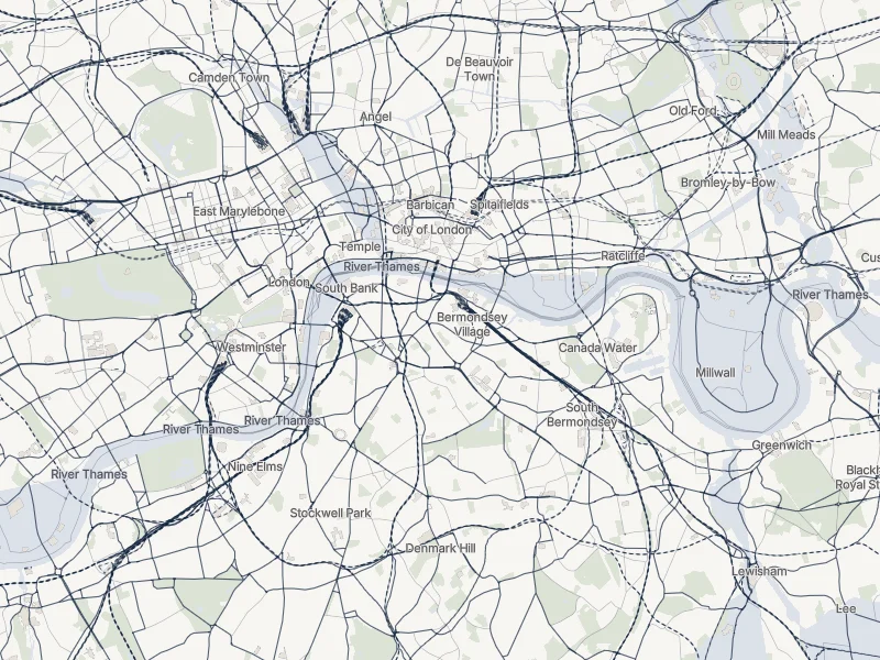
A map of central London along the River Thames showing water, buildings, roads, rail and green space, with an optional shaded layer for the area at risk of flooding.
An interactive map of central London built from open data. Switch the layers on and off to see how water, transport, buildings and flood risk relate. © OpenStreetMap contributors (ODbL). Contains Environment Agency information © Environment Agency and/or database right (Open Government Licence v3.0).


Used where it helps.
For some projects, AI and machine learning can help sort data, find patterns or prepare information for a model.
They are optional. Many experiences do not need them. Outputs need review in the context of the question being asked.
Make the complex visible.
Source information is prepared and shaped into a digital representation. That representation can then become an immersive experience people can walk through and question.
Each step is chosen to fit the place and the purpose.


Want to see how it could work for your place?
